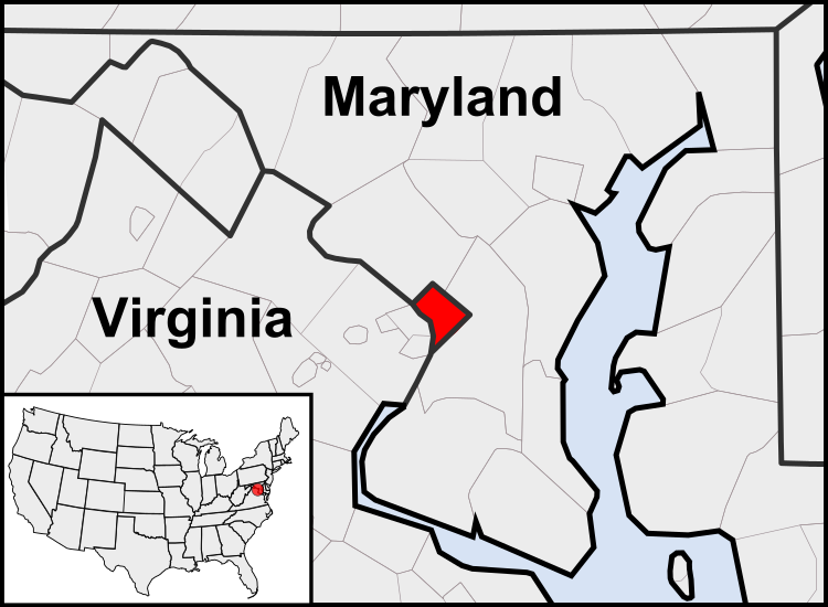
فائل:Washington, D.C. locator map.svg

Size of this PNG preview of this SVG file: 750*550 پڪزلس. ٻيا تحلل:320*235 پڪزلس | 640*469 پڪزلس | 1,024*751 پڪزلس | 1,280*939 پڪزلس | 2,560*1,877 پڪزلس
اصلوڪو فائيل (ايسويجي فائيل، اٽڪل 750 × 550 عڪسلون، فائيل سائيز: 160 KB)
فائيل جي سوانح
ڪنھن بہ تاريخ/وقت تي ٽڙڪ ڪري ڏسندا تہ ان وقت اهو فائيل ڪيئن هو.
| تاريخ/وقت | آڱوٺي ننھن | ماپَ | واپرائيندڙ | راءِ | |
|---|---|---|---|---|---|
| موجود نسخو | 03:23, 23 جُولاءِ 2011 |  | 750 × 550 (160 KB) | Patrickneil | Reverted to version as of 03:04, 23 July 2011 |
| 03:21, 23 جُولاءِ 2011 |  | 750 × 550 (161 KB) | Patrickneil | Reverted to version as of 03:14, 23 July 2011 | |
| 03:20, 23 جُولاءِ 2011 |  | 750 × 550 (161 KB) | Patrickneil | frame | |
| 03:14, 23 جُولاءِ 2011 |  | 750 × 550 (161 KB) | Patrickneil | thicker frame | |
| 03:04, 23 جُولاءِ 2011 |  | 750 × 550 (160 KB) | Patrickneil | straightening Maryland and Delaware borders | |
| 02:09, 15 آگسٽ 2010 |  | 750 × 550 (202 KB) | Patrickneil | Delaware River again | |
| 01:51, 15 آگسٽ 2010 |  | 750 × 550 (274 KB) | Patrickneil | Delaware River border | |
| 01:42, 15 آگسٽ 2010 |  | 750 × 550 (273 KB) | Patrickneil | forgot border on Smith Island | |
| 01:34, 15 آگسٽ 2010 |  | 750 × 550 (273 KB) | Patrickneil | county borders below state | |
| 01:32, 15 آگسٽ 2010 |  | 750 × 550 (274 KB) | Patrickneil | changes by request |
ڳنڍڻا
هن فائيل سان هيٺيان صفحا ڳنڍيل آهن.
گلوبل فائيل جو استعمال
ھيٺيون وڪيز بہ ھيءُ فائيل استعمال ڪن ٿيون:
- af.wikipedia.org تي استعمال
- an.wikipedia.org تي استعمال
- ar.wikipedia.org تي استعمال
- arz.wikipedia.org تي استعمال
- as.wikipedia.org تي استعمال
- azb.wikipedia.org تي استعمال
- bh.wikipedia.org تي استعمال
- bs.wikipedia.org تي استعمال
- ceb.wikipedia.org تي استعمال
- ckb.wikipedia.org تي استعمال
- en.wikipedia.org تي استعمال
- en.wikinews.org تي استعمال
- es.wikipedia.org تي استعمال
- es.wiktionary.org تي استعمال
- et.wikipedia.org تي استعمال
- fr.wikipedia.org تي استعمال
- fr.wiktionary.org تي استعمال
- fy.wikipedia.org تي استعمال
- gv.wikipedia.org تي استعمال
- hu.wikipedia.org تي استعمال
- ia.wikipedia.org تي استعمال
- id.wikipedia.org تي استعمال
- ilo.wikipedia.org تي استعمال
- Umuna a Panid
- Washington, D.C.
- Wikipedia:Ammom kadi/2013
- Plantilia:Ammom kadi/Agosto 3
- Plantilia:Ammom kadi/Septiembre 22
- Plantilia:Ammom kadi/Nobiembre 11
- Plantilia:Ammom kadi/Disiembre 31
- Plantilia:Ammom kadi/Enero 16
- Plantilia:Ammom kadi/Marso 6
- Plantilia:Ammom kadi/Abril 25
- Plantilia:Ammom kadi/Hunio 14
- Wikipedia:Nasalakniban-sariap a bambanag/Umuna a Panid/2
- Wikipedia:Nasalakniban-sariap a bambanag/Umuna a Panid/3
- incubator.wikimedia.org تي استعمال
- it.wikipedia.org تي استعمال
- jam.wikipedia.org تي استعمال
- ja.wikipedia.org تي استعمال
- jbo.wikipedia.org تي استعمال
- ko.wikipedia.org تي استعمال
- lb.wikipedia.org تي استعمال
ھن فائيل جو وڌيڪ گلوبل استعمال ڏسو.