فائل:UK Outline and Flag.svg

Size of this PNG preview of this SVG file: 407*600 پڪزلس. ٻيا تحلل:163*240 پڪزلس | 326*480 پڪزلس | 521*768 پڪزلس | 695*1,024 پڪزلس | 1,390*2,048 پڪزلس | 661*974 پڪزلس
اصلوڪو فائيل (ايسويجي فائيل، اٽڪل 661 × 974 عڪسلون، فائيل سائيز: 109 KB)
| تشريح |
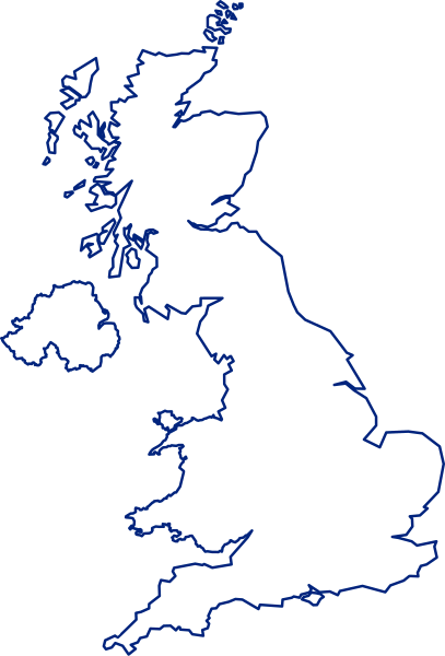
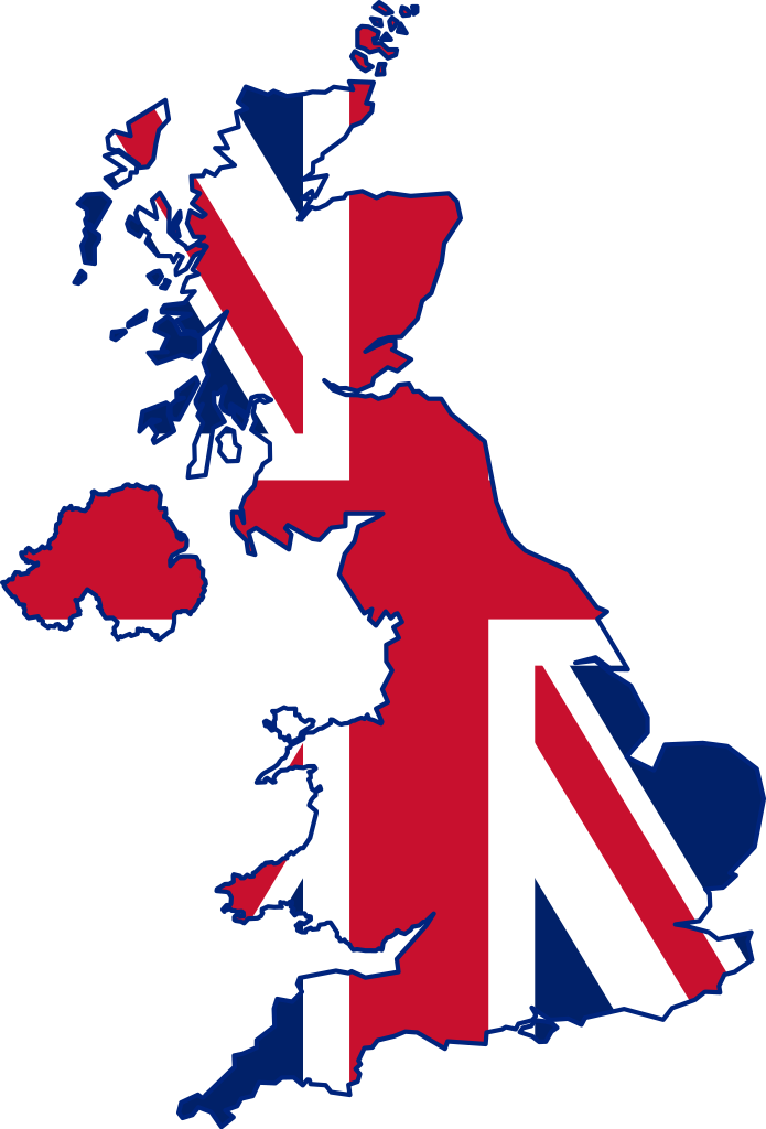
English: A map of the United Kingdom, overlaid with the UK flag.
Русский: Флаг-карта Соединённого Королевства |
||
| تاريخ | |||
| ذريعو | ڪم پنھنجايو | ||
| ليکڪ | Inductiveload | ||
| اجازت (ھن فائيل کي وَراستعمال ڪندي) |
|
||
| Other versions |
 |
||
| SVG genesis |
فائيل جي سوانح
ڪنھن بہ تاريخ/وقت تي ٽڙڪ ڪري ڏسندا تہ ان وقت اهو فائيل ڪيئن هو.
| تاريخ/وقت | آڱوٺي ننھن | ماپَ | واپرائيندڙ | راءِ | |
|---|---|---|---|---|---|
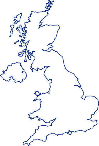
| موجود نسخو | 15:14, 24 جُولاءِ 2021 | | 661 × 974 (109 KB) | GPinkerton | Improve flag geometry, remove Isle of Man (not strictly part of the UK). Shetland (definitely a part) still missing ... |
| 20:40, 10 جنوري 2015 |  | 720 × 1,000 (130 KB) | AnonMoos | Reverted to version as of 09:28, 15 January 2012 -- unfortunately, the new upload is less clear when displayed at a small size, and filesize was bloated over 1000% | |
| 16:03, 9 جنوري 2015 |  | 419 × 750 (1.71 MB) | Stasyan117 | border and islands | |
| 09:28, 15 جنوري 2012 |  | 720 × 1,000 (130 KB) | Gajmar | Blue borders | |
| 19:33, 3 فيبروري 2008 |  | 720 × 1,000 (129 KB) | Inductiveload | fix white fill on borders | |
| 19:23, 3 فيبروري 2008 |  | 720 × 1,000 (100 KB) | Inductiveload | {{Information |Description=A map of the United Kingdom, overlaid with the UK flag. |Source=self-made |Date=03/02/2008 |Author= Inductiveload |Permission={{PD-self}} |other_versions= }} Category:Maps of the United Kingdom |
ڳنڍڻا
هن فائيل سان هيٺيان صفحا ڳنڍيل آهن.
گلوبل فائيل جو استعمال
ھيٺيون وڪيز بہ ھيءُ فائيل استعمال ڪن ٿيون:
- ace.wikipedia.org تي استعمال
- ar.wikipedia.org تي استعمال
- غرينتش
- جزر الأنتيل الكبرى
- غيرنزي
- قائمة مدن المملكة المتحدة
- خط الطول الأول (غرينتش)
- إكسمنستر
- جزر كايمان
- ويكيبيديا:صناديق المستخدم/بلدان
- دمبارتون
- شابينساي
- سان بيتر بورت
- بروفيدنسياليس
- جزيرة الطيور (المملكة المتحدة)
- سندرلاند
- بيليمينا
- تورفين
- تلة كليف
- الجمعية الجغرافية الملكية
- لوستويزيل
- نهر فاوي
- بولستيد
- كادسدن
- إنفرنيس
- أسكوت
- سالفورد
- وايت تشابل
- هارلو
- توتون
- دوكنج (نورفولك)
- سودرك
- هامرسميث
- لافيونا
- إيلي (كامبريدجشير)
- برايتون أند هوف
- تشيلمسفورد (إسكس)
- تشيتشستر
- ريبون (شمال يوركشير)
- مدينة ولز (إنجلترا)
- خليج ماساشوستس
- مستخدم:Sylvia Ford
- دونكاستر
- ويندرمير (كمبريا)
- ويندرمير
- وايتستابل
- ساوث سي
- لوثيان الشرقية
- آلدرني
- شوريهام
ھن فائيل جو وڌيڪ گلوبل استعمال ڏسو.