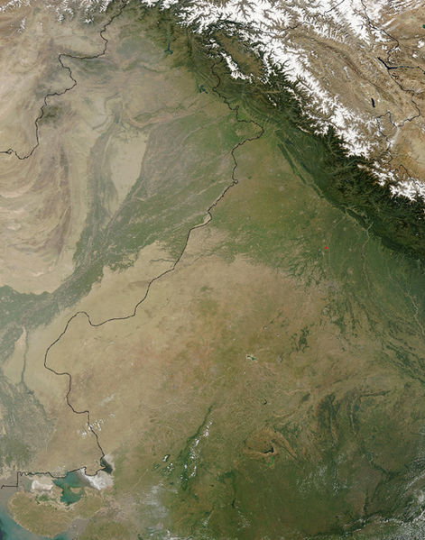
فائل:Thar Desert satellite.jpg

هن پيش-نگاھ جي ماپ: 471*599 پڪزلس. ٻيا تحلل:189*240 پڪزلس | 500*636 پڪزلس
اصلوڪو فائيل (500 × 636 عڪسلون، فائيل سائيز: 329 KB، MIME ٽائيپ: image/jpeg)
فائيل جي سوانح
ڪنھن بہ تاريخ/وقت تي ٽڙڪ ڪري ڏسندا تہ ان وقت اهو فائيل ڪيئن هو.
| تاريخ/وقت | آڱوٺي ننھن | ماپَ | واپرائيندڙ | راءِ | |
|---|---|---|---|---|---|
| موجود نسخو | 14:25, 17 سيپٽمبر 2005 |  | 500 × 636 (329 KB) | Crux | Satellite Image of Thar Desert, India/Pakistan (border line in the middle) from en:, uploaded by en:User:Tom Radulovich |
ڳنڍڻا
هن فائيل سان هيٺيان صفحا ڳنڍيل آهن.
گلوبل فائيل جو استعمال
ھيٺيون وڪيز بہ ھيءُ فائيل استعمال ڪن ٿيون:
- ar.wikipedia.org تي استعمال
- az.wikipedia.org تي استعمال
- bg.wikipedia.org تي استعمال
- bn.wikipedia.org تي استعمال
- bs.wikipedia.org تي استعمال
- ckb.wikipedia.org تي استعمال
- de.wikipedia.org تي استعمال
- en.wikipedia.org تي استعمال
- eo.wikipedia.org تي استعمال
- es.wikipedia.org تي استعمال
- et.wikipedia.org تي استعمال
- fa.wikipedia.org تي استعمال
- fi.wikipedia.org تي استعمال
- fr.wikipedia.org تي استعمال
- he.wikipedia.org تي استعمال
- hu.wikipedia.org تي استعمال
- it.wikipedia.org تي استعمال
- ja.wikipedia.org تي استعمال
- ka.wikipedia.org تي استعمال
- kk.wikipedia.org تي استعمال
- kn.wikipedia.org تي استعمال
- ko.wikipedia.org تي استعمال
- ky.wikipedia.org تي استعمال
- lfn.wikipedia.org تي استعمال
- lt.wikipedia.org تي استعمال
- mai.wikipedia.org تي استعمال
- mg.wikipedia.org تي استعمال
- mk.wikipedia.org تي استعمال
- ml.wikipedia.org تي استعمال
- mr.wikipedia.org تي استعمال
- ms.wikipedia.org تي استعمال
- ne.wikipedia.org تي استعمال
- nn.wikipedia.org تي استعمال
- pa.wikipedia.org تي استعمال
- pl.wikipedia.org تي استعمال
- pnb.wikipedia.org تي استعمال
ھن فائيل جو وڌيڪ گلوبل استعمال ڏسو.

