فائل:Pre-roman iron age (map).PNG
هن پيش-نگاھ جي ماپ: 577*600 پڪزلس. ٻيا تحلل:231*240 پڪزلس | 462*480 پڪزلس | 657*683 پڪزلس
اصلوڪو فائيل (657 × 683 عڪسلون، فائيل سائيز: 38 KB، MIME ٽائيپ: image/png)
تَتُ
| تشريح |
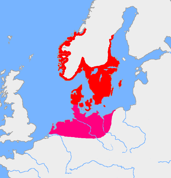
English: Map of the Nordic Iron Age and the Jastorf culture. |
||
| تاريخ | |||
| ذريعو | Image:Europe plain rivers.png and the Harper Atlas of World History (ed. Vidal-Naquet) in Swedish translation: Atlas över mänsklighetens historia. | ||
| ليکڪ | Copied from en:, uploaded by Wiglaf | ||
| Other versions |
|

.PNG)
لائيسنسڪاري
| This work has been released into the public domain by its author, Wiglaf. This applies worldwide. In some countries this may not be legally possible; if so: |
فائيل جي سوانح
ڪنھن بہ تاريخ/وقت تي ٽڙڪ ڪري ڏسندا تہ ان وقت اهو فائيل ڪيئن هو.
| تاريخ/وقت | آڱوٺي ننھن | ماپَ | واپرائيندڙ | راءِ | |
|---|---|---|---|---|---|
| موجود نسخو | 05:43, 8 آگسٽ 2017 | | 657 × 683 (38 KB) | Velivieras | Updated the map concerning the Åland islands. Scandinavian influence to the island started in 11th century. |
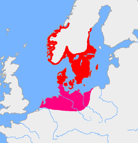
| 07:26, 15 آگسٽ 2005 |  | 657 × 683 (32 KB) | Square87~commonswiki | from en.wiki {{PD}} |
ڳنڍڻا
هن فائيل سان هيٺيان صفحا ڳنڍيل آهن.
گلوبل فائيل جو استعمال
ھيٺيون وڪيز بہ ھيءُ فائيل استعمال ڪن ٿيون:
- af.wikipedia.org تي استعمال
- als.wikipedia.org تي استعمال
- ast.wikipedia.org تي استعمال
- be.wikipedia.org تي استعمال
- ca.wikipedia.org تي استعمال
- ca.wiktionary.org تي استعمال
- cs.wikipedia.org تي استعمال
- da.wikipedia.org تي استعمال
- da.wikibooks.org تي استعمال
- de.wikipedia.org تي استعمال
- eml.wikipedia.org تي استعمال
- en.wikipedia.org تي استعمال
- eo.wikipedia.org تي استعمال
- es.wikipedia.org تي استعمال
- et.wikipedia.org تي استعمال
- eu.wikipedia.org تي استعمال
- fa.wikipedia.org تي استعمال
- fi.wikipedia.org تي استعمال
- fi.wikibooks.org تي استعمال
- fr.wikipedia.org تي استعمال
- fr.wikiversity.org تي استعمال
- fr.wiktionary.org تي استعمال
ھن فائيل جو وڌيڪ گلوبل استعمال ڏسو.
.PNG)
.PNG)