فائل:PeriplusAncientMap.jpg
هن پيش-نگاھ جي ماپ: 763*600 پڪزلس. ٻيا تحلل:305*240 پڪزلس | 611*480 پڪزلس | 977*768 پڪزلس | 1,280*1,006 پڪزلس | 1,524*1,198 پڪزلس
اصلوڪو فائيل (1,524 × 1,198 عڪسلون، فائيل سائيز: 239 KB، MIME ٽائيپ: image/jpeg)
تَتُ
| تشريح |
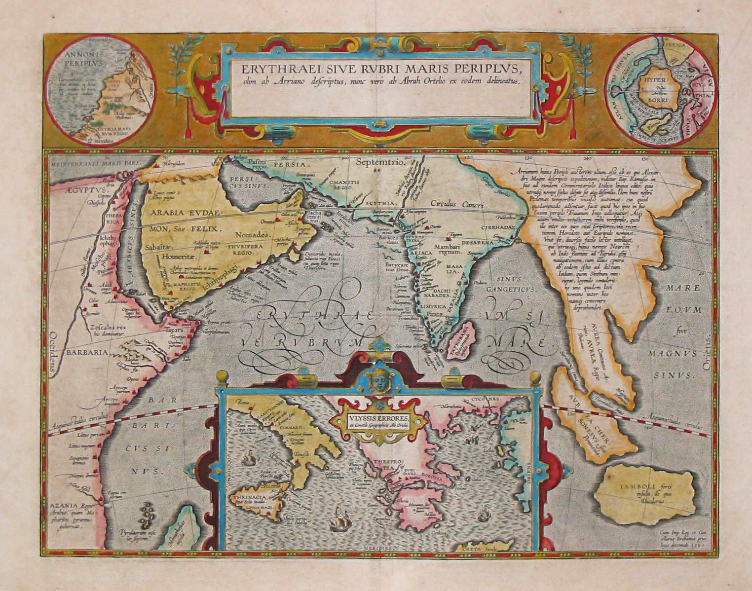
English: Map by Abraham Ortelius, (1527-1598) for the Periplus Maris Erythraei (Περίπλους τὴς Ἐρυθράς Θαλάσσης "Periplus of the Erythraean Sea"), attributed to Arrian. |
|||||||||||||||||||||||
| تاريخ | ||||||||||||||||||||||||
| ذريعو | Plate [162] from: Theatrum orbus terrarum / Abraham Ortelius. Antverpiae: Apud Ioannem Bapt. Vrintium, 1609. | |||||||||||||||||||||||
| ليکڪ |
|
|||||||||||||||||||||||

See also:
لائيسنسڪاري
|
This is a faithful photographic reproduction of a two-dimensional, public domain work of art. The work of art itself is in the public domain for the following reason:
The official position taken by the Wikimedia Foundation is that "faithful reproductions of two-dimensional public domain works of art are public domain".
This photographic reproduction is therefore also considered to be in the public domain in the United States. In other jurisdictions, re-use of this content may be restricted; see Reuse of PD-Art photographs for details. | ||||
فائيل جي سوانح
ڪنھن بہ تاريخ/وقت تي ٽڙڪ ڪري ڏسندا تہ ان وقت اهو فائيل ڪيئن هو.
| تاريخ/وقت | آڱوٺي ننھن | ماپَ | واپرائيندڙ | راءِ | |
|---|---|---|---|---|---|
| موجود نسخو | 08:10, 24 مارچ 2007 | | 1,524 × 1,198 (239 KB) | World Imaging | Ancient map (17th century) depicting the locations of the Periplus of the Erythraean Sea. |
ڳنڍڻا
هن فائيل سان هيٺيان صفحا ڳنڍيل آهن.
گلوبل فائيل جو استعمال
ھيٺيون وڪيز بہ ھيءُ فائيل استعمال ڪن ٿيون:
- ar.wikipedia.org تي استعمال
- as.wikipedia.org تي استعمال
- bn.wikipedia.org تي استعمال
- br.wikipedia.org تي استعمال
- ca.wikipedia.org تي استعمال
- cs.wikipedia.org تي استعمال
- de.wikipedia.org تي استعمال
- el.wikipedia.org تي استعمال
- en.wikipedia.org تي استعمال
- es.wikipedia.org تي استعمال
- fa.wikipedia.org تي استعمال
- fa.wikibooks.org تي استعمال
- fr.wikipedia.org تي استعمال
- he.wikipedia.org تي استعمال
- hif.wikipedia.org تي استعمال
- hi.wikipedia.org تي استعمال
- hr.wikipedia.org تي استعمال
- hu.wikipedia.org تي استعمال
- ilo.wikipedia.org تي استعمال
- it.wikipedia.org تي استعمال
- ja.wikipedia.org تي استعمال
- la.wikipedia.org تي استعمال
- no.wikipedia.org تي استعمال
- oc.wikipedia.org تي استعمال
- or.wikipedia.org تي استعمال
- pnb.wikipedia.org تي استعمال
- ru.wikipedia.org تي استعمال
- sh.wikipedia.org تي استعمال
- simple.wikipedia.org تي استعمال
- sl.wikipedia.org تي استعمال
ھن فائيل جو وڌيڪ گلوبل استعمال ڏسو.