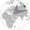
فائل:Azerbaijan with Nagorno Karabakh region.svg

Size of this PNG preview of this SVG file: 600*600 پڪزلس. ٻيا تحلل:240*240 پڪزلس | 480*480 پڪزلس | 768*768 پڪزلس | 1,024*1,024 پڪزلس | 2,048*2,048 پڪزلس | 689*689 پڪزلس
اصلوڪو فائيل (ايسويجي فائيل، اٽڪل 689 × 689 عڪسلون، فائيل سائيز: 578 KB)
فائيل جي سوانح
ڪنھن بہ تاريخ/وقت تي ٽڙڪ ڪري ڏسندا تہ ان وقت اهو فائيل ڪيئن هو.
| تاريخ/وقت | آڱوٺي ننھن | ماپَ | واپرائيندڙ | راءِ | |
|---|---|---|---|---|---|
| موجود نسخو | 08:49, 24 نومبر 2020 |  | 689 × 689 (578 KB) | Golden | add a white dotted border around NKR |
| 08:46, 24 نومبر 2020 |  | 689 × 689 (578 KB) | Golden | Fix the borders of other countries; add more detail to new NKR | |
| 17:23, 15 نومبر 2020 |  | 551 × 551 (462 KB) | RufinaFridwald | Updating Karabagh related maps | |
| 12:40, 10 نومبر 2020 |  | 551 × 551 (421 KB) | Ratherous | Reverted to version as of 14:32, 4 November 2020 (UTC) User blocked. Wait on the change until boundaries are clear | |
| 14:11, 5 نومبر 2020 |  | 551 × 551 (462 KB) | CastorAeolus | Reverted to version as of 11:34, 27 October 2020 (UTC) No I won't. | |
| 14:32, 4 نومبر 2020 |  | 551 × 551 (421 KB) | MrLune | Reverted to version as of 18:00, 13 December 2019 (UTC) Wait the war end for map edit | |
| 11:34, 27 آڪٽوبر 2020 |  | 551 × 551 (462 KB) | CastorAeolus | Update | |
| 18:00, 13 ڊسمبر 2019 |  | 551 × 551 (421 KB) | Goran tek-en | Added border for South Sudan as requested by {{u|Maphobbyist}} | |
| 08:04, 27 اپريل 2012 |  | 551 × 551 (571 KB) | Interfase | {{Information |Description ={{en|1=Map of Azerbaijan (with Nagorno-Karabakh region) on the map of the world.}} |Source =Self-made from Azerbaijan (orthographic projection).svg |Author ... |
ڳنڍڻا
ڪي بہ صفحا ناھن جيڪي ھن فائيل کي استعمال ڪندا ھجن.
گلوبل فائيل جو استعمال
ھيٺيون وڪيز بہ ھيءُ فائيل استعمال ڪن ٿيون:
- az.wikipedia.org تي استعمال
- en.wikipedia.org تي استعمال
- fr.wikipedia.org تي استعمال
- ru.wikipedia.org تي استعمال
- www.wikidata.org تي استعمال
- zh.wikipedia.org تي استعمال