فائل:Ap-districts.png

هن پيش-نگاھ جي ماپ: 722*600 پڪزلس. ٻيا تحلل:289*240 پڪزلس | 578*480 پڪزلس | 925*768 پڪزلس | 1,233*1,024 پڪزلس | 2,487*2,066 پڪزلس
اصلوڪو فائيل (2,487 × 2,066 عڪسلون، فائيل سائيز: 714 KB، MIME ٽائيپ: image/png)
| تشريح |
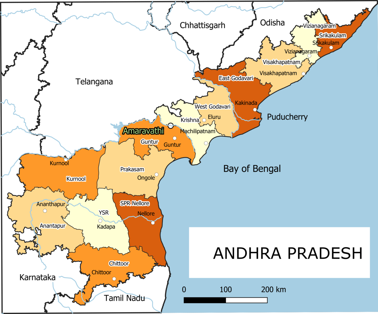
English: Old Andhra Pradesh Map
For more information please see: File:ఆంధ్రప్రదేశ్ జిల్లాల పటము.png |
| تاريخ | |
| ذريعو | ڪم پنھنجايو |
| ليکڪ | Arjunaraoc |
| Other versions | For the latest version see File:Ap-districts.svg |
; for older version see https://commons.wikimedia.org/w/index.php?title=File:Map_AP_dist_all_shaded.png&oldid=344558866 ,
لائيسنسڪاري
I, the copyright holder of this work, hereby publish it under the following license:
| This work contains information from OpenStreetMap, which is made available under the Open Database License (ODbL).
The ODbL does not require any particular license for maps produced from ODbL data. Prior to 1 August 2020, map tiles produced by the OpenStreetMap Foundation were licensed under the CC-BY-SA-2.0 license. Maps produced by other people may be subject to other licences. |
فائيل جي سوانح
ڪنھن بہ تاريخ/وقت تي ٽڙڪ ڪري ڏسندا تہ ان وقت اهو فائيل ڪيئن هو.
| تاريخ/وقت | آڱوٺي ننھن | ماپَ | واپرائيندڙ | راءِ | |
|---|---|---|---|---|---|
| موجود نسخو | 12:12, 25 ڊسمبر 2021 | | 2,487 × 2,066 (714 KB) | Arjunaraoc | Created new version with clean state boundaries using OSM and natural earth data |
| 09:29, 27 مارچ 2019 |  | 2,485 × 2,064 (770 KB) | Arjunaraoc | fixed few labels going outside graphic | |
| 08:01, 27 مارچ 2019 |  | 2,485 × 2,064 (770 KB) | Arjunaraoc | Corrected the boundaries of Andhra Pradesh districts impacted by State division in 2014. For more information check details in File:ఆంధ్రప్రదేశ్ జిల్లాల పటము.png | |
| 08:21, 2 نومبر 2015 |  | 600 × 600 (76 KB) | Kannadabheri | Cross-wiki upload from en.wikipedia.org |
ڳنڍڻا
هن فائيل سان هيٺيان صفحا ڳنڍيل آهن.
گلوبل فائيل جو استعمال
ھيٺيون وڪيز بہ ھيءُ فائيل استعمال ڪن ٿيون:
- bn.wikipedia.org تي استعمال
- ha.wikipedia.org تي استعمال
- hi.wikipedia.org تي استعمال
- hu.wikipedia.org تي استعمال
- oc.wikipedia.org تي استعمال
- sat.wikipedia.org تي استعمال
- tcy.wikipedia.org تي استعمال