فائل:African continent-en.svg

Size of this PNG preview of this SVG file: 635*600 پڪزلس. ٻيا تحلل:254*240 پڪزلس | 508*480 پڪزلس | 813*768 پڪزلس | 1,084*1,024 پڪزلس | 2,169*2,048 پڪزلس | 1,525*1,440 پڪزلس
اصلوڪو فائيل (ايسويجي فائيل، اٽڪل 1,525 × 1,440 عڪسلون، فائيل سائيز: 752 KB)
| تشريح |
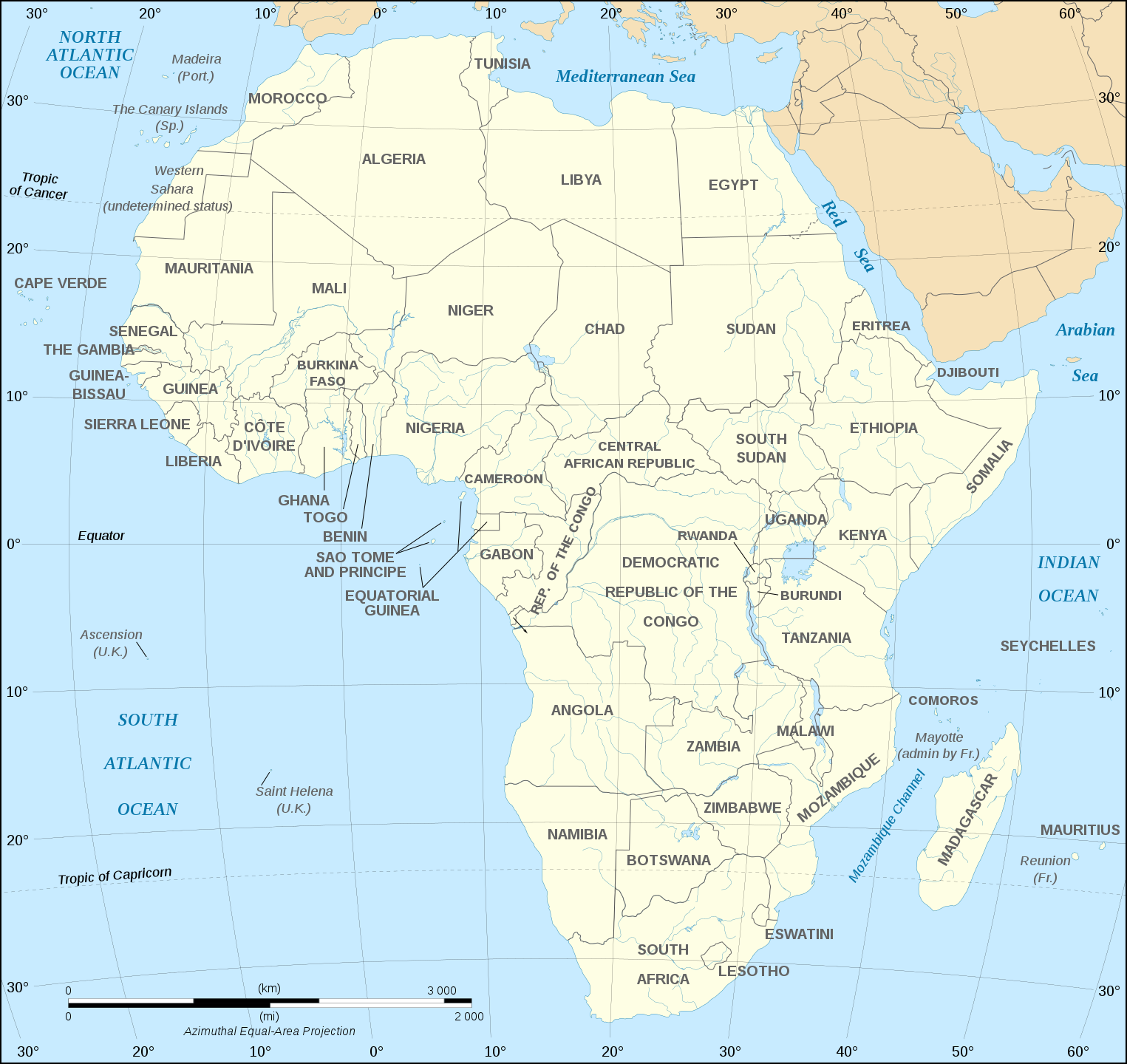
English: Map of the African continent as in 2011-07.
Français : Carte en anglais du continent africain tel qu'en 07/2011.
Lambert azimutal equal-area projection, WGS84 datum, standard meridian: 15°E, standard parallel: 0°Scale: 1:15,000,000 (accuracy: 3,75 km) |
||
| تاريخ | (UTC), updated 2011-07 | ||
| ذريعو | |||
| ليکڪ |
|
||
| Other versions |
Derivative works of this file:
[]
Map close to Africa map political-fr.svg, but with some changes on the islands administrated by European countries and the Sinai peninsula |
||
| SVG genesis |
|


I, the copyright holder of this work, hereby publish it under the following license:
This file is licensed under the Creative Commons Attribution-Share Alike 2.5 Generic, 2.0 Generic and 1.0 Generic license.
- توھان آزاد آھيو:
- ونڊڻ لاءِ – اھو ڪم نقل ڪرڻ، ورڇڻ، ۽ پارمڪارڻ
- جڳلبندي ڪرڻ – ڪم اختيار ڪرڻ لاءِ
- ھيٺين شرطن تي:
- انتساب – توهان لازماً مناسب انتساب ڏيو، اجازتنامي ڏانھن ڳنڍڻو مھيا ڪريو، ۽ جيڪڏھن ڪي تبديليون ڪيون ويون ھجن تہ انھن جي نشاندھي ڪريو. توهان اهو ڪري سگهو ٿا ڪنھن بہ معقول طريقي سان، پر ڪنھن بہ اھڙي طريقي سان نہ جيڪو ڏسي تہ اجازتنامو ڏيندڙ توهان جي يا توهان جي استعمال جي توثيق ڪري ٿو.
- ھڪجھڙي ڀاڱيداري – جيڪڏھن توھان ٻيھر ملاوٽ، بدلاءُ، يا مواد تي اڏاوت ڪريو ٿا، توھان کي لازماً پنھنجون ڀاڱيداريون ساڳي يا موافق اجازتنامي جھڙو اصل جو ھيو، ھيٺ ٻيھر-ورھائڻ گهرجن.
Original upload log
This image is a derivative work of the following images:
- Image:Africa_map_blank.svg licensed with Cc-by-sa-2.5,2.0,1.0, Cc-by-sa-2.5,2.0,1.0/en
- 2008-06-27T03:34:58Z Sting 1525x1440 (711453 Bytes) Completely new drawing with known projection
- 2006-05-31T15:28:42Z Sting 1390x1295 (571519 Bytes) Enhanced version : African and Asian continents separated
- 2006-05-31T03:53:32Z Sting 1390x1295 (566642 Bytes) {{Information |Description=Blank vector graphic map of [[:Category:Maps of Africa|Africa]] |Source=Several bitmap-type maps |Date= May 2006 |Author= Eric Gaba ({{U|Sting}}) |Permission=GFDL or CC-BY-SA |other_version
Uploaded with derivativeFX
فائيل جي سوانح
ڪنھن بہ تاريخ/وقت تي ٽڙڪ ڪري ڏسندا تہ ان وقت اهو فائيل ڪيئن هو.
| تاريخ/وقت | آڱوٺي ننھن | ماپَ | واپرائيندڙ | راءِ | |
|---|---|---|---|---|---|
| موجود نسخو | 18:21, 6 ڊسمبر 2020 | | 1,525 × 1,440 (752 KB) | Sting | Swatziland => eSwatini |
| 19:59, 14 جُولاءِ 2011 |  | 1,525 × 1,440 (752 KB) | Sting | Sudan/South Sudan 2011-07 border update | |
| 16:42, 16 ڊسمبر 2010 |  | 1,525 × 1,440 (747 KB) | Sting | Spelling correction: Madeira | |
| 20:16, 10 جنوري 2009 |  | 1,525 × 1,440 (747 KB) | Sting | Correction Sao Tome | |
| 08:37, 6 ڊسمبر 2008 |  | 1,525 × 1,440 (750 KB) | Bobarino | {{Information |Description={{en|Map of the African continent.}} {{fr|Carte vierge du continent africain.}} Lambert azimutal equal-area projection, WGS84 datum, standard meridian: 15°E, standard pa |
ڳنڍڻا
هن فائيل سان هيٺيان صفحا ڳنڍيل آهن.
گلوبل فائيل جو استعمال
ھيٺيون وڪيز بہ ھيءُ فائيل استعمال ڪن ٿيون:
- af.wikipedia.org تي استعمال
- ar.wikipedia.org تي استعمال
- azb.wikipedia.org تي استعمال
- az.wiktionary.org تي استعمال
- de.wikipedia.org تي استعمال
- en.wikipedia.org تي استعمال
- fa.wikipedia.org تي استعمال
- hi.wikipedia.org تي استعمال
- hu.wikibooks.org تي استعمال
- id.wikipedia.org تي استعمال
- ig.wikipedia.org تي استعمال
- ilo.wikipedia.org تي استعمال
- ja.wikipedia.org تي استعمال
- ko.wikipedia.org تي استعمال
- www.mediawiki.org تي استعمال
- ml.wikipedia.org تي استعمال
- mn.wikipedia.org تي استعمال
- nl.wikipedia.org تي استعمال
- simple.wikipedia.org تي استعمال
- sw.wikipedia.org تي استعمال
- te.wikipedia.org تي استعمال
- th.wikipedia.org تي استعمال
- tr.wikipedia.org تي استعمال
- uz.wikipedia.org تي استعمال
- yo.wikipedia.org تي استعمال